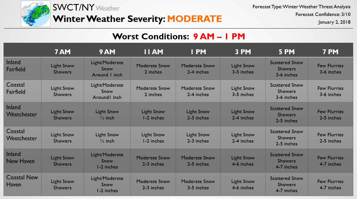
The below forecast is one piece of our Storm Threat Alert published earlier today for Premium subscribers. The standard Storm Threat Alert is 3 pages, outlining school/travel impacts as well as accumulation, timing, and offering a forecast discussion. Below we show the preliminary expectation for accumulation and timing for the snow threat on Thursday. It should be emphasized that this forecast is very preliminary, however, as the region looks to see a tight gradient between steady snow across eastern portions and lighter snow across western portions. Additionally, there remain solid timing differences between modeling guidance that need to be worked out tomorrow.
We will continue to pass along forecast updates as they come. To get the first Updates on the storm and see forecast school impacts you can subscribe here, otherwise stay tuned as we will pass along broader Free forecasts for the system as it approaches.