by SWCT/NY Weather | Mar 5, 2018 | Public
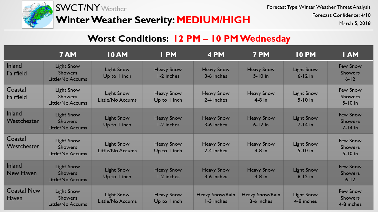
Below we have attached part of the Premium forecast that we recently sent out to subscribers. That forecast includes the latest school and travel impacts as well as more frequent updates and a detailed storm discussion. We will continue to pass along free portions of this forecast as it shifts with the upcoming storm. The forecast is made more difficult due to the risk of snow mixing with rain yet again across coastal areas. Rain mixing in appears most likely across coastal New Haven County, where forecast snow accumulations are accordingly the lowest. Meanwhile, across inland Westchester County we currently expect the heaviest precipitation and lowest odds of rain mixing in, resulting in the highest forecast accumulations there. Significant travel impacts seem very possible later in the day on Wednesday.
SWCT/NY Premium will have far more detailed content, though, and for a limited time you can use the coupon code “MARCHDEAL” and receive 50% off your first year of SWCT/NY Premium! Give it a try here and see how we can help keep you ahead of this upcoming significant snow storm.

by SWCT/NY Weather | Feb 28, 2018 | Public
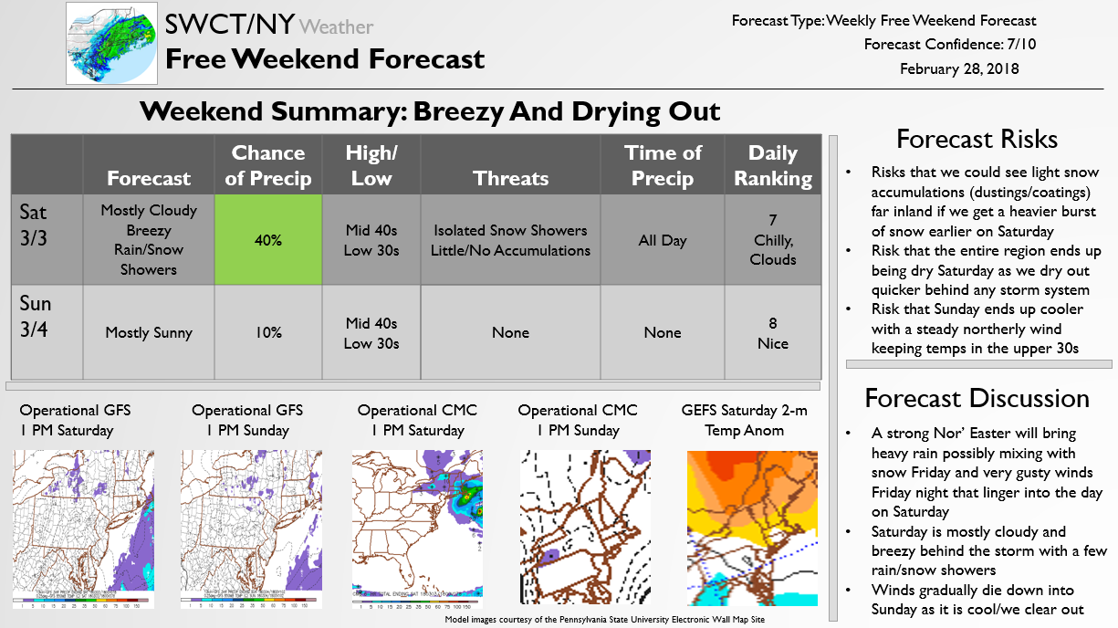
The below Free Weekend Look provides a free forecast for the upcoming weekend, outlining where forecast risks lie and discussing exactly what to expect. Generally this weekend looks to be breezy but dry with a few lingering rain/snow showers on Saturday following what will be a very intense Nor’ Easter on Friday. We have been outlining the storm Friday for Premium clients, discussing school risks and potential impacts. If it is expected to be significant enough we will pass along a free version of the forecast later tomorrow as well, as isolated power outages later on Friday should accompany heavy rain that could turn to snow inland.

by SWCT/NY Weather | Feb 21, 2018 | Public
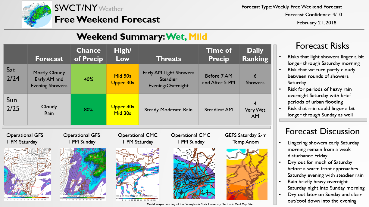
This Free Weekend Look is published once a week on Wednesday to provide an idea of how the forecast is shaping up for the upcoming weekend. Generally we are looking at a relatively wet and mild weekend, with early morning showers ending Saturday for a mostly cloudy day before evening showers move in and become steady overnight. Briefly heavy rain may be possible Saturday night into Sunday morning before that disturbance moves on out. We are also tracking the potential for light sleet to bring afternoon travel trouble tomorrow across the region and a light icing threat Friday as well, with Premium updates for subscribers outlining expected travel and school impacts.

by SWCT/NY Weather | Feb 17, 2018 | Public
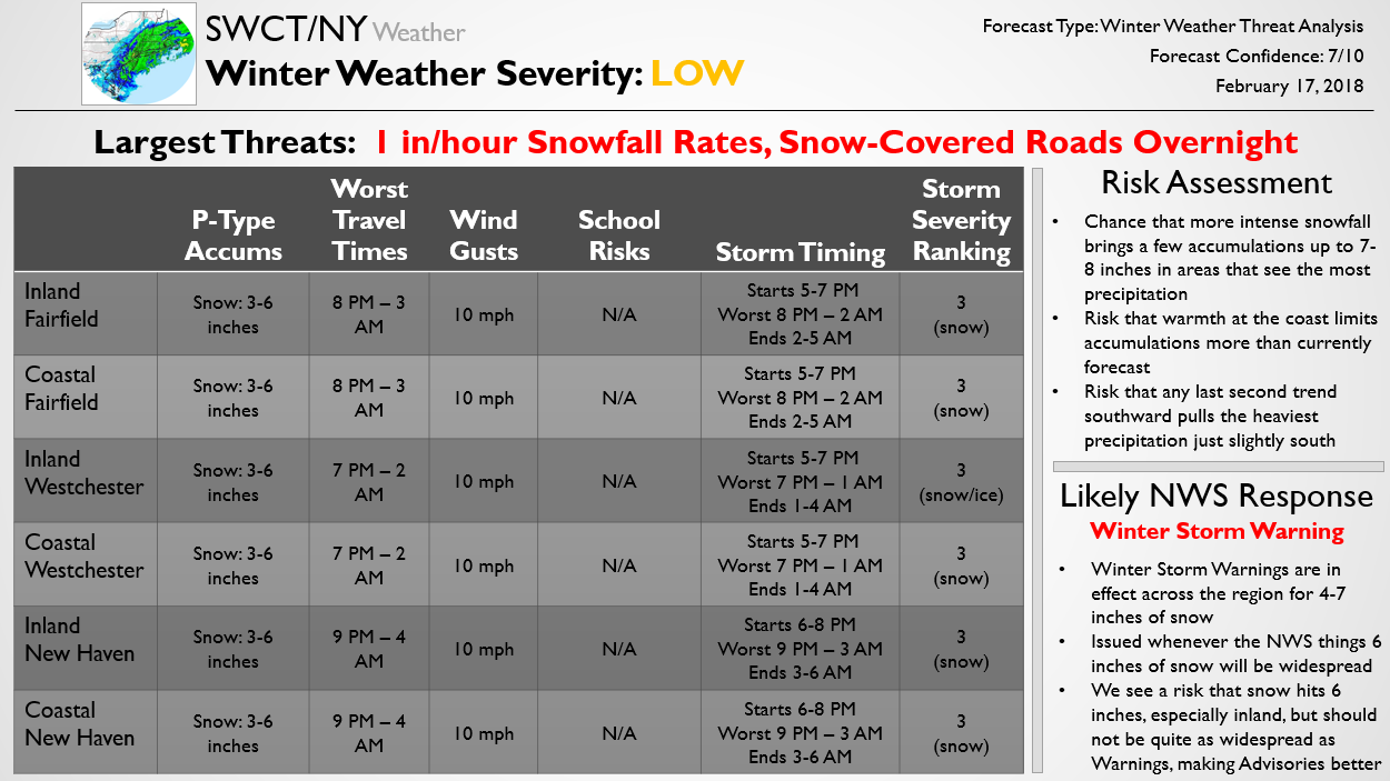
The below Free Update was recently sent to Premium subscribers, who have received the latest forecast in detail over the past few days. We are expecting a moderate snow event tonight as briefly heavy snow falls with a quick-moving system to overcome marginal surface temperatures and bring travel impacts after 8-9 PM.

by SWCT/NY Weather | Feb 14, 2018 | Public
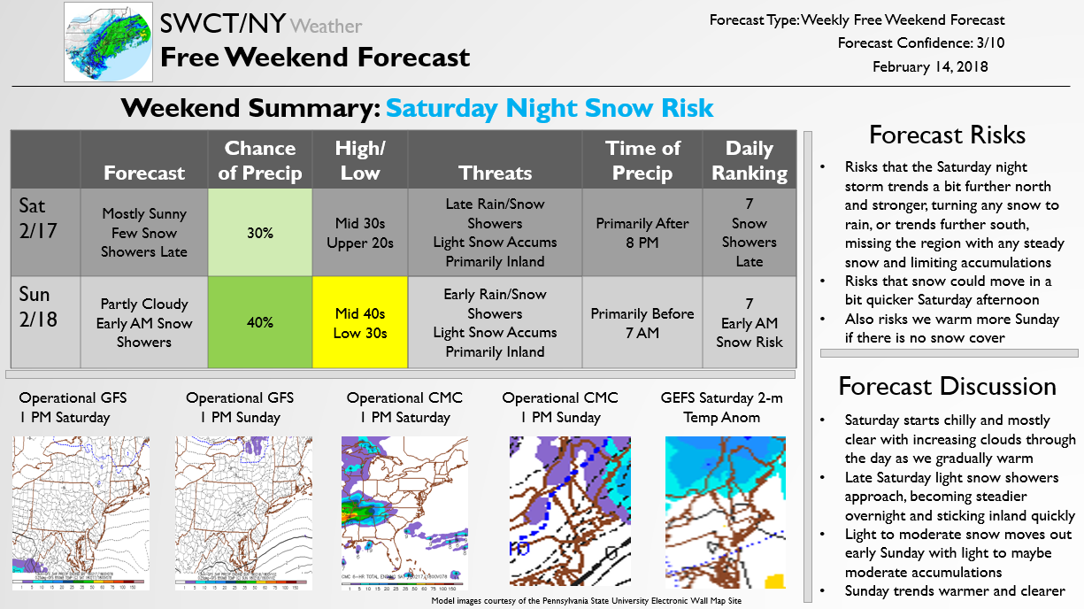
The below forecast is published for free every Wednesday looking ahead to the coming weekend. This week’s forecast focuses on a light to moderate snow threat for the region Saturday night. Impacts are likely to be limited based on the timing Saturday and it will have to thread the needle perfectly to bring moderate accumulating snow to the region, but there is at least a threat for snow Saturday night worth following.

by SWCT/NY Weather | Feb 6, 2018 | Public
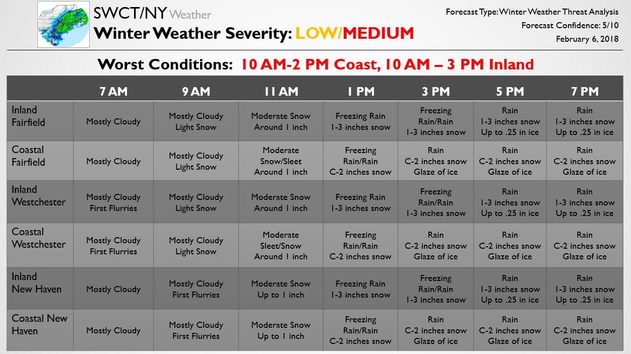
The below forecast was published to Premium subscribers earlier this morning outlining expectations for the upcoming storm. Through the day model guidance has come in to a consensus quite close to this forecast and at this point it remains unchanged. The National Weather Service has issued a Winter Weather Advisory that matches it as well. We do not expect significant changes to it overnight, but small tweaks are possible that could still significantly change the exact timing and magnitude of travel impacts tomorrow. Another Premium Update is coming this evening with all the latest, and any larger changes will be passed along for Free here as well.
