January 29 Free Weather Update & Brief Storm Info
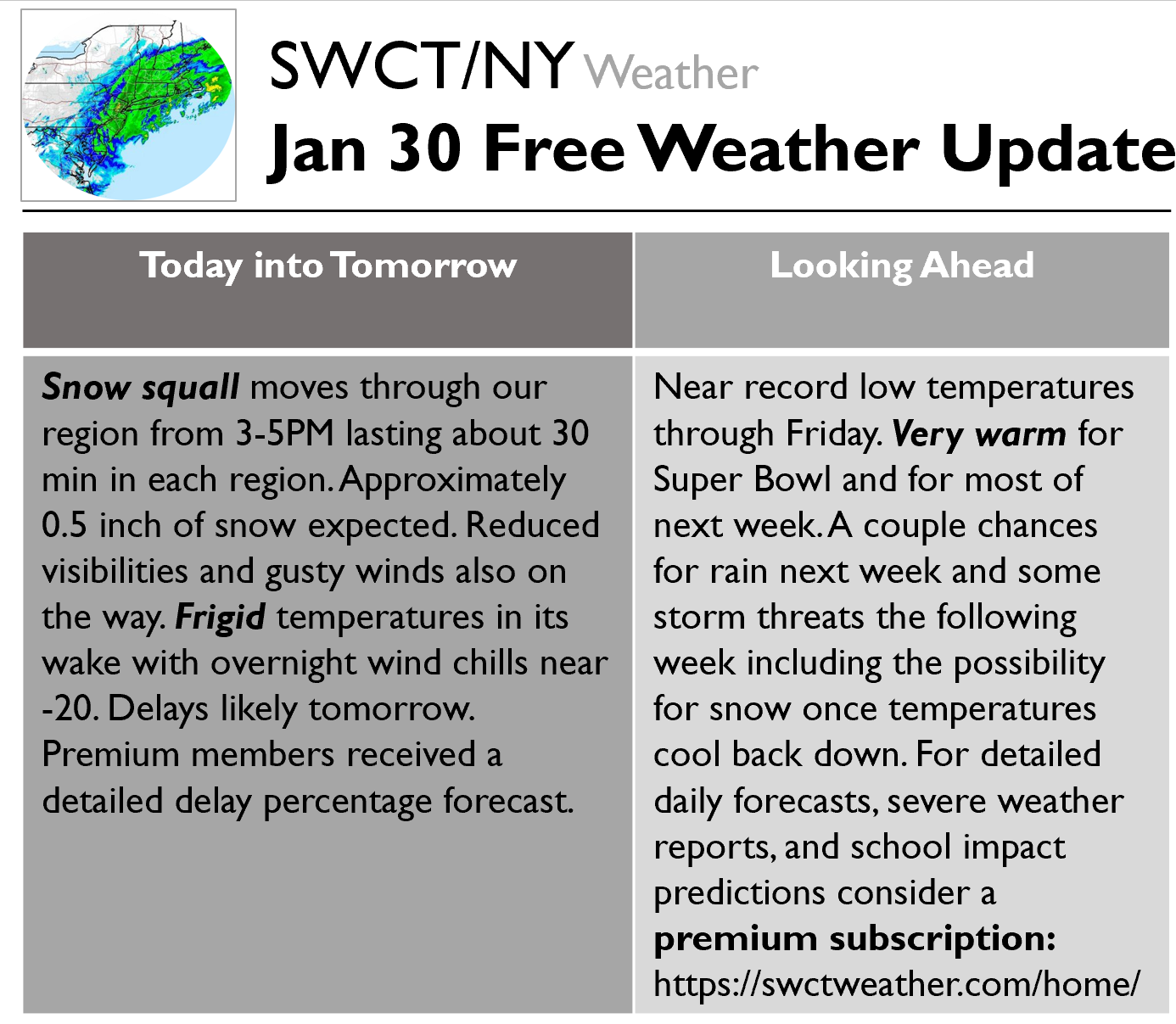
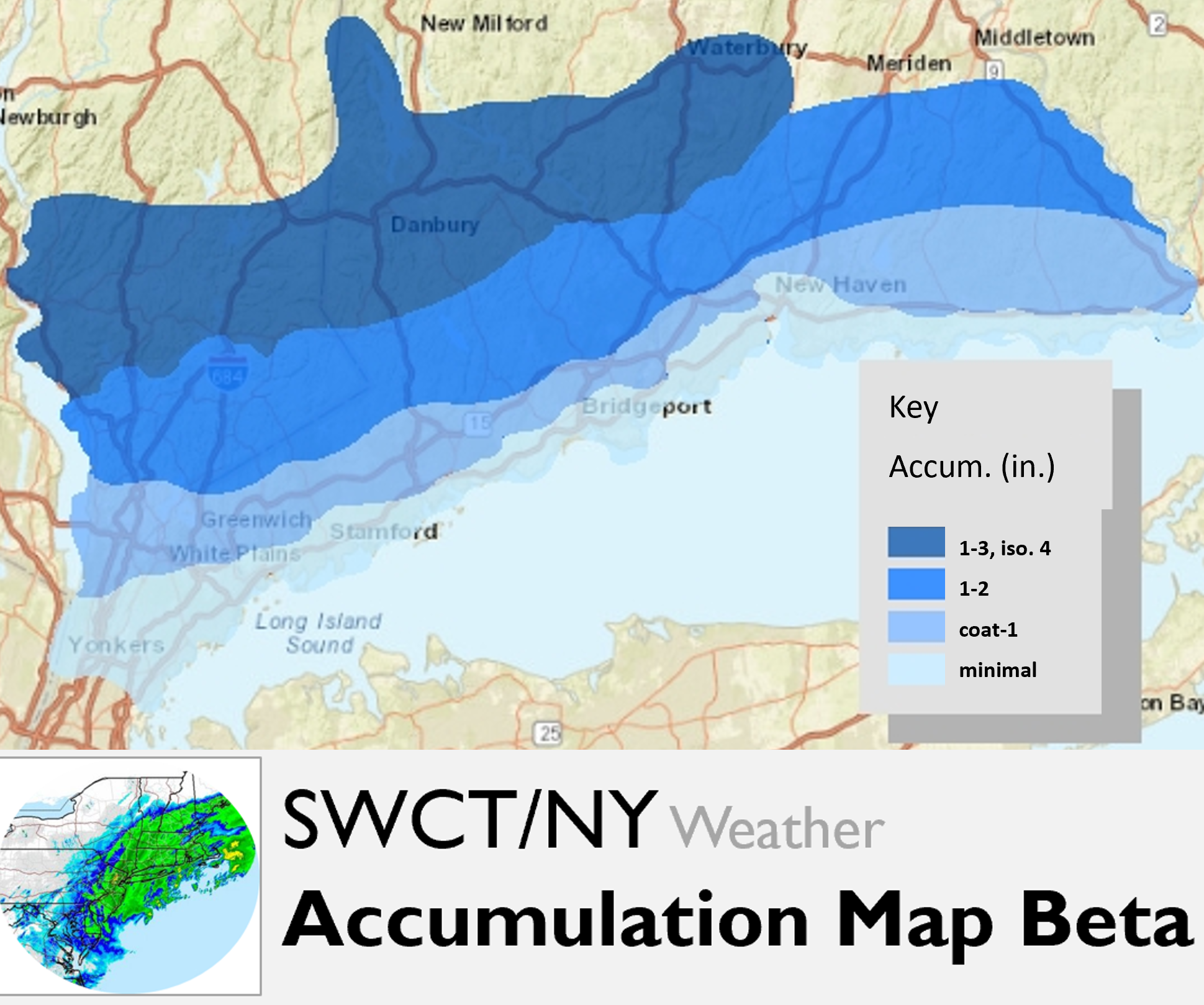
Good afternoon. Here is some info on today’s storm & upcoming weather as well as an SWCT Beta Accumulation Map for tonight into tomorrow. We see that far inland areas see the best chance for school impacts and additional snow accumulations. Gusty winds will continue through the day Wednesday and Thursday. There is uncertainty as always. Particularly, whether the snow struggles to stick to the roads will play a huge role. Earlier today we measured the road temperature in northern Westchester to be about 33 degrees so the roads are nearing the freezing point far inland. Feel free to reach out with questions. Premium subscribers just received an email with detailed timing of precipitation, school impact percent predictions, and detailed discussion.
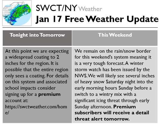
January 17 Free Weather Update
January 16 Free Weather Update
This content is for members onlyJanuary 15 Free Weather Update
This content is for members onlyNovember 15 Free Storm Forecast
Earlier today we sent out multiple Premium forecasts for subscribers, and have been sending out live Text Message Alerts keeping them aware of the latest developments with the storm. Our Morning Update updated snowfall expectations as the storm looks likely to bring moderate snowfall. To view the latest school and travel impact analysis and begin receiving our text message alerts, try out a Premium subscription here. The below excerpt is from that Morning Update:
Overall, the key themes of this storm remain unchanged, as we should start as snow and then mix with sleet, freezing rain, and eventually turn to all rain across the region. Overnight models came into better agreement about a bit more snow falling than sleet, though they also warmed the surface slightly after 7-8 PM indicating that freezing rain may be slightly less of a threat and thus plain rain can come earlier tonight. The first main change to the forecast was to bump up snowfall accumulation expectations across the board. We are now calling for 2-5 inches at the coast and 3-6 inches inland of heavy snow/sleet accumulations. There will be enough moisture for even more snow hypothetically, but at least some sleet mixing in should broadly limit these accumulations, with the main question being how much. We see at least a couple hours of heavy inch per hour snow falling at the coast, which is why we can now confidently call for 2 inches of snow falling there, whereas inland we see at least 3 hours of inch per hour snow and have raised our forecast there as well. If the mix with sleet holds off until 7-8 PM, as some models show, we could see 4-6 hours of heavy, inch per hour snow across the region between 3-8 PM generally, hence the upside targets. The moisture will be there, and precipitation will be quite heavy, but it is a question of how much sleet mixes in which would really keep snowfall ratios down. Surface temperatures at the coast initially may be a bit above freezing too but should come down with heavy snow; after they initially fall though they rise through the evening and with any sleet and then rain we may see snow compact, making measurements a bit harder too. The highest accumulations will be likely on grassy cold surfaces where snow is more easily able to accumulate right away. The main upside risk to this snowfall forecast is that the turn to sleet only happens once the heaviest snow moves through and far inland areas could see over 6 inches (though this is not particularly likely). The main downside risk is that the warm layer trends just a bit stronger and we see a quick transition to sleet after only an inch or two of snow.
We also slightly updated the start time of the storm, as snow could start in western portions of coastal Westchester County as early as 1 PM. We would see steadier snow begin to move in by 2 PM across Westchester County as the heavy snow moves in by 3 PM. The first snow should be in Fairfield County by 2-3 PM and heavy snow there moves in between 3 and 4 PM, with the heaviest snow likely waiting to move into New Haven County between 4 and 5 PM. Between 4 and 6 PM across the region we should see transitions between snow and sleet, with snow dominating but sleet mixing in at times due to warm layers in the atmosphere. Surface temperatures should fall so that road conditions rapidly deteriorate by 4 PM across the region though, and we likely go back to all snow after 6 PM with the heaviest precipitation helping mix out the warm layer. By 7 PM we should see the main warm layer moving across the region though that will begin turning Westchester County and coastal Fairfield County over to sleet, and by 9 PM the whole region should be turning over to sleet. We see a quick transition to plain rain at the coast by 10 PM at the latest tonight as surface temperatures rise into the mid 30s, whereas inland a rain/freezing rain mix takes over between 10 and 11 PM, but by 1 AM even most inland areas should be seeing plain rain. These light to moderate rain showers should continue on and off into Friday morning, with a brief burst of snow then possible around 8 or 9 AM when the back end of the storm moves out (though it would be unlikely to stick).

