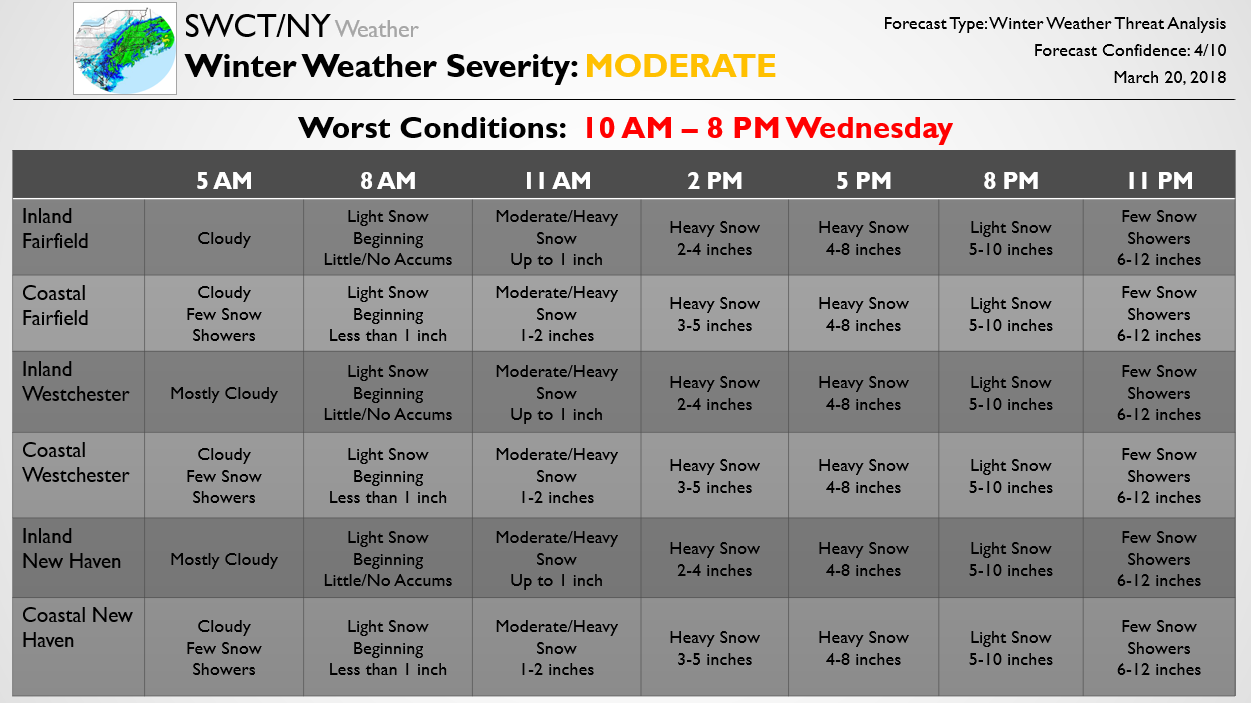
The below forecast is one piece of a Storm Threat Alert sent out to our Premium members earlier for the storm. That Alert also includes a more detailed discussion along with forecast risks, school closure/early dismissal percentage chances, and details on potential travel impacts. As can be seen in our below forecast, a rather significant storm is forecast for the region with the entire region likely to see at least half a foot of snow. Amounts of a foot are possible across the coast and primarily western areas, where models show precipitation heaviest, though the entire region could get into the heaviest banding and see impressive accumulations. There are significant risks in both directions here; some short-term models show more impressive banding that could bring accumulations over a foot to much of the region. Other guidance shows dry air winning out inland and potentially lower accumulations as well, so there are risks in both directions. We have a number Updates on the way for Premium subscribers and will pass along any significant changes to the accumulation forecast as well. We are continuing to run our March deal which is half off your first year on SWCT/NY Premium; sign up for that here!