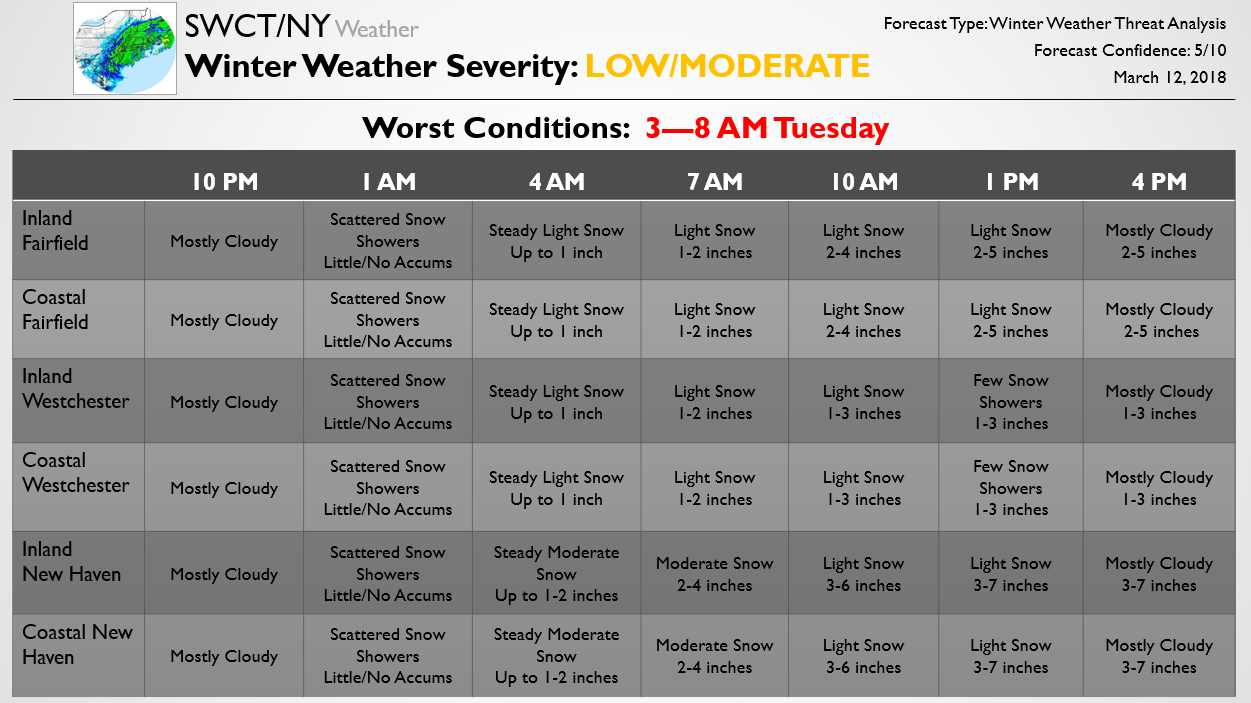
The below forecast is one piece of the Update Premium subscribers got a few hours ago detailing expected school and travel impacts from a Nor’ Easter tonight into tomorrow. Below we outline timing, precipitation type, and expected accumulations across the region. We will continue to pass along any timing and accumulation forecast adjustments through the day as a sharp snowfall gradient looks to set up across the region, with the heaviest snow across eastern areas and the lightest snow across western areas. The large snow accumulation ranges in each county are due to expected tight gradients, with eastern areas of each county likely receiving the most snow and western areas likely receiving the least snow, though there will be some deviations within any banding. For more details on how schools are likely to be impacted tomorrow and the latest forecasts/analysis, try out a Premium subscription here.