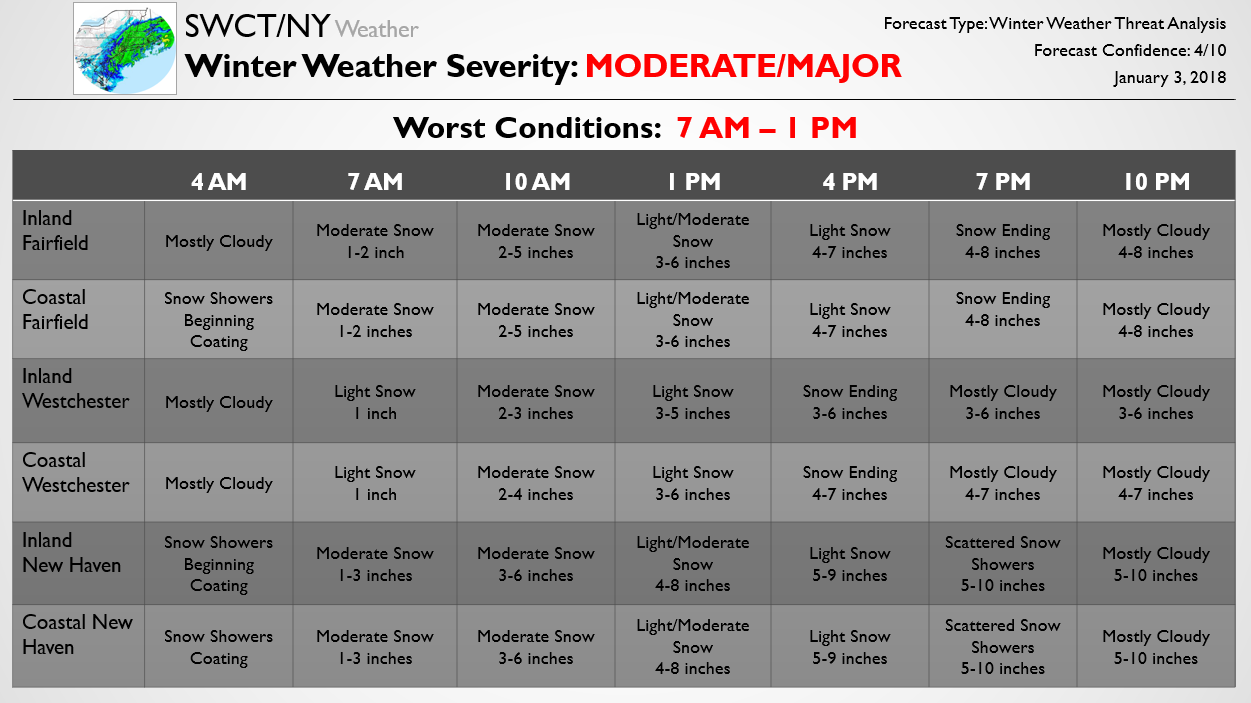
The below forecast is one piece of our Storm Threat Alert published at 10 AM for Premium subscribers. The standard Storm Threat Alert is 3 pages, outlining school/travel impacts as well as accumulation, timing, and offering a forecast discussion. The below Update shows the updated accumulation and timing expectations for the storm across the region. Confidence still sits a bit below average with this storm as there looks to be a rather sharp snowfall gradient across the region, and any small shift in the precipitation shield could have a rather significant impact on accumulations. It is likely that this forecast will continue to be revised through the evening.
Additionally, we are worried about gusty winds with the storm, with wind gusts up to 45 mph at the coast and 40 mph or so inland. This could result in isolated power outages across the region. Though not widespread, extreme cold will move in behind the storm, with low temperatures in the single digits tomorrow night and potentially below 0 Friday night. Sub-zero wind chills both nights are possible as well. Please have a plan in place in case you lose power; though it is not likely, it is a threat we are currently monitoring due to these wind gusts.
We will continue to pass along each Update as the forecast is tweaked ahead of this winter storm. To get the full Updates on the storm in advance and see forecast school impacts you can subscribe here, otherwise be sure to stay tuned as we will pass along additional Free updates today.