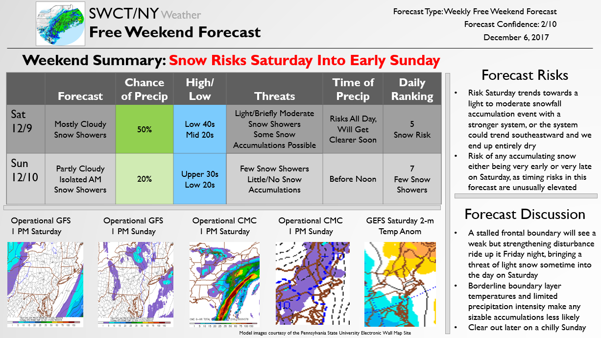
The below forecast is issued once a week on Wednesdays for free, outlining expected weather conditions for the upcoming weekend. Confidence sits significantly below average with the forecast for the weekend due to a snow threat focused sometime on Saturday. Model guidance shows a wide array of scenarios, where anything from no snow at all to a light/moderate snowfall accumulation is possible. Upper level temperatures will be low enough for snow to be the predominant precipitation type, but there are a number of moving parts that limit current forecast confidence and indicate this forecast is likely to change significantly over the next 48-72 hours.
We will publish additional free Updates should it appear that the storm is likely to bring impacts to the region. These will likely contain pieces of our Premium forecasts. Our Premium forecasts, as always, will include detailed model discussions and risk assessments as well as accumulation/timing forecasts and expected school, business, and travel impact analyses. These are published in advance of our Free Updates, and you can get those by subscribing here. Otherwise, we will continue to pass along Free updates here that outline timing and accumulation expectations, ensuring you stay ahead of incoming winter weather.
As we outlined to our Premium clients earlier today as well, a wintry pattern looks to remain through the long-range, indicating a number of additional snow chances into the end of the year. We can expect business for at least a few weeks (and potentially quite a bit longer), so be sure to stay tuned!